The story
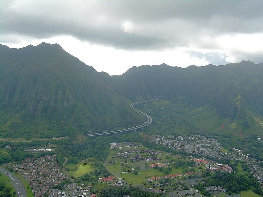
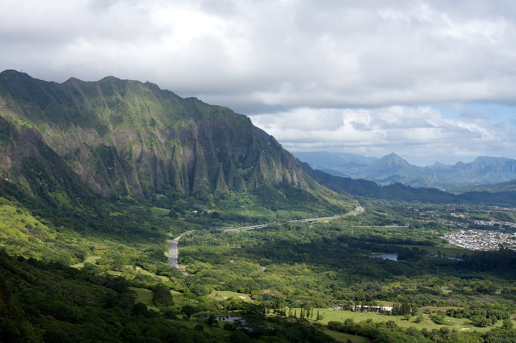
The mountain did not want a hole through it. The Koʻolau Range is a fossil volcano, its windward face eaten to a vertical wall by a million years of trade-wind rain, its rock stacked from thousands of individual lava flows separated by nearly impermeable dikes. Engineers in 1911 looked at that wall and saw an obstacle. They also saw a way through: collect the streams on the wet side and carry the water under the crest by gravity. What the bore struck, groundwater pent up behind the dikes, was a surprise. Waiāhole Ditch is the system they built. It runs 2.76 miles where it crosses under the mountain crest, part of a 26.5-mile collection and delivery system that begins in Kahana Valley on the wet windward side of Oʻahu and ends in the cane fields of Kunia on the dry leeward plain. It has moved, on average, 27 million gallons of water a day since 1916. And in the year 2000, a lawsuit over that water produced a water-rights ruling, one still being cited in Hawaiʻi courtrooms today.
A Company Solves an Arithmetic Problem

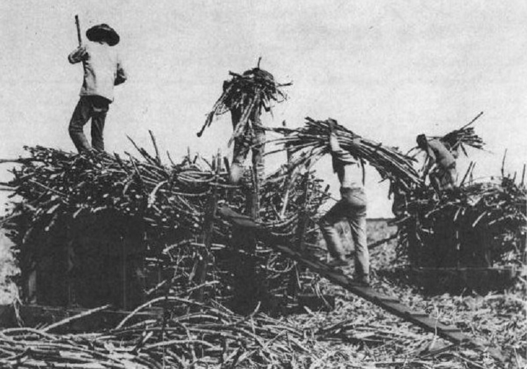
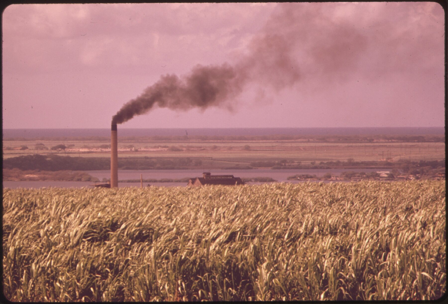
Sugar is thirsty. Oʻahu Sugar Company, planting cane on the flat, sun-baked plains of central Oʻahu, had been pumping groundwater out of the Pearl Harbor aquifer to keep its fields alive, and pumping costs money. Diesel and electricity have to be paid for; gravity is free. Across the Koʻolau summit, windward valleys such as Waiāhole, Waikāne, and Kahana received some of the highest rainfall in the Hawaiian Islands, and much of that water simply ran to the sea. In August 1911, consulting engineer J. B. Lippincott, building on earlier surveys by Jorgen Jorgensen, reported to the company's board that windward stream water could be driven through the mountain and delivered to the plantation by gravity alone, and the board approved the general plan. Lippincott's trip to Oʻahu was a working vacation from his regular job: at the time, he was serving as assistant chief engineer of Los Angeles's Owens River Aqueduct, then under construction, and he took a three-week leave from that job in August 1911 specifically to study the Koʻolau tunnel plan. The plan called for gathering water from the many streams and gulches of windward Oʻahu through a network of tunnels bored into the ridges and spurs above the valleys, then channeling it into one long transmission bore through the mountain itself.
Building the Bore
Construction started in February 1913, carried out by the Waiāhole Water Company, a subsidiary that Oʻahu Sugar Company created to build and run the system. Crews worked three eight-hour shifts around the clock, drilling and blasting through basalt in tunnels roughly seven feet wide and seven feet high. The work was cold and wet; tunnel water ran at about 66 degrees Fahrenheit, and at the flooded north heading the company later moved to four six-hour shifts to reduce the toll of standing in it for so long. The work killed people, too: a blasting accident in June 1913 left one man dead, a Shay locomotive that left the track badly burned its engineer the following month, and in November a powderman was blown out of one of the leeward delivery tunnels after lingering too long lighting his fuses.
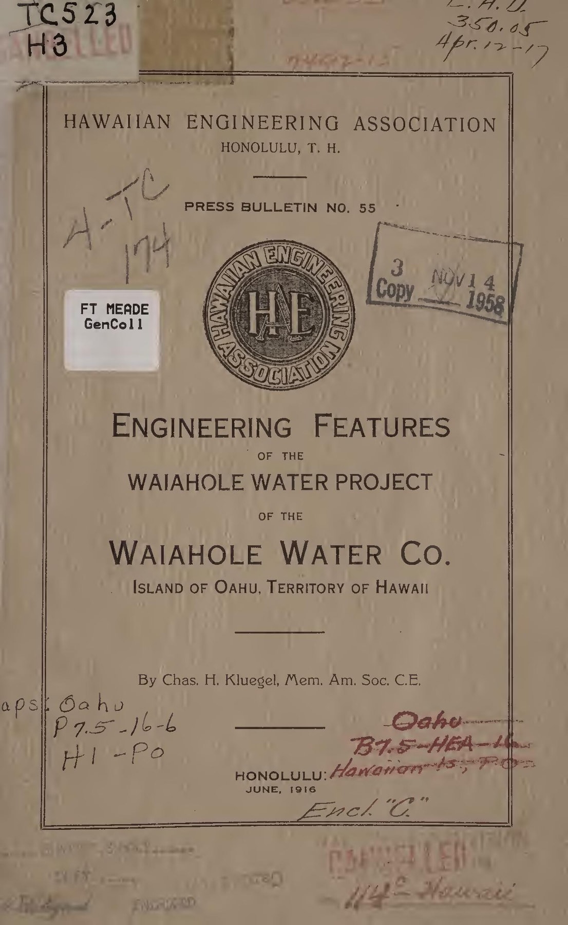
The 1916 engineering report by Charles H. Kluegel, the company's inspecting engineer, credited the Japanese crews in these words: "They were on the job all the time and never failed to deliver the goods in situations in which white men or native Hawaiians would have been physically impossible." No individual worker or labor contractor from those crews is named in the engineering report or the federal documentation of the ditch, only the collective, backhandedly admiring judgment of the men who employed them.
Partway through construction, crews broke through a rock barrier and released an unplanned two million gallons a day of impounded groundwater, a discovery that complicated the excavation but confirmed the mountain was holding far more water than anyone had measured from outside it. By July 1915, enough of the delivery system, open ditches and siphons, was finished to carry water released during tunneling to Oʻahu Sugar's cane fields. Continuous operation of the completed system began on May 27, 1916, under superintendent H. Olstad.
Twenty-Seven Tunnels and a Redwood Board
The finished system had dozens of tunnels. Twenty-seven separate tunnels on the windward side, totaling 4.66 miles, fed water into the 2.76-mile main bore that carried it under the summit to its leeward exit, an opening engineers named Adit 8. Water was collected at elevations as high as 790 feet and delivered to the plantation boundary at 650 feet, dropping through the whole system by gravity alone. Between 1925 and 1935, the company drove six more development tunnels chasing dike-impounded groundwater at even higher altitudes; four of them, named Uwao, Waikāne 1, Waikāne 2, and Kahana, proved productive enough to justify the drilling. In 1963 and 1964 the company lengthened the Uwao tunnel. At the heart of the system sat a piece of technology almost comic in its simplicity next to the tunnels beneath it: a single redwood board, seven feet by seven feet and three inches thick, which a 1997 newspaper report described as the original from 1916, raised or lowered a few chain links at a time to decide how much water went to leeward fields and how much went back into Waiāhole Stream.
What the Mountain Held
The mountain the engineers drilled into was a reservoir. USGS hydrologists estimate that tunnels driven into the Koʻolau Range have drained at least 50 billion gallons from its dike compartments, out of a total they put at roughly 560 billion gallons above sea level. Before the tunnels, that water mostly discharged slowly through natural seeps and springs into windward streams. USGS hydrologists calculated that the Waiāhole tunnel system alone drained about 46 billion gallons of stored water, most of it while the tunnels were being driven, which is most of the water that all Koʻolau tunnels together have drained. High-elevation springs that had once discharged nearly 6 million gallons a day dried up entirely. USGS estimates that, with the ditch diverting its dike water, Waiāhole Stream's low flows at 250 feet had fallen to about a quarter of natural flow before releases began in 1994. The steepest decline came after 1963, when the Uwao tunnel was extended and pulled nearly 3 million more gallons a day out of the system. Residents who remembered the valleys from the 1940s through the 1960s described streams that had once run clean, cold, and swift year-round, full of native ʻoʻopu (goby), ʻōpae (shrimp), and hīhīwai (snail) in numbers far larger than anyone would see again. Witnesses in the contested case said that restoring the streams to their pre-ditch condition would be very difficult, and that the historic flow of Waiāhole Stream is unknown.
Water Leaves, People Stay
The people who depended on that water mostly stayed, even after the water left. Waiāhole and Waikāne remained agricultural valleys, worked for generations by families growing kalo (taro) and rice on land whose ownership traced back to a very different kind of dispossession. In about 1899, Lincoln Loy McCandless acquired title from the government to roughly 35 percent of Waiāhole Valley. By the 1970s his daughter, Elizabeth Marks, was partnering with developer Joe Pao to convert the land to suburban housing. When Hawaiʻi's Land Use Commission rejected their 1974 rezoning request, they moved to evict tenant farmers anyway, filing eviction proceedings and raising rents on many who remained. The Waiāhole-Waikāne Community Association organized the valley's remaining farmers and staged protests. In January 1977, when word came that police were on their way to carry out evictions, residents and supporters blocked Kamehameha Highway. The confrontation pushed the Hawaiʻi Housing Authority to buy several hundred acres from Marks (795 acres, by the state housing agency's own count) and lease it to the farmers who worked it. An old Hawaiian saying, ke kalo paʻa o Waiāhole, "the hard taro of Waiāhole," is recorded by Mary Kawena Pukui as a reminder not to treat others badly. That fight was about land. It built the organization, the relationships, and the standing that the same community would need two decades later, when the water itself came under legal challenge.
The Ditch Runs Dry of Purpose
For 77 years, the arrangement held: sugar took the water, farmers made do with what was left. Then, in August 1993, Oʻahu Sugar Company announced it would end its sugar operations by 1995. The announcement ended a business and orphaned 27 million gallons of daily water flow with no obvious legal claimant. The state's Commission on Water Resource Management had designated windward Oʻahu's groundwater a protected management area the year before, in July 1992, requiring every existing user of ditch water to apply for a formal permit. As word spread that the plantation was closing, a queue of very different applicants formed at once. The state Department of Agriculture filed to reserve ditch flow for farming generally. The Office of Hawaiian Affairs, the Department of Hawaiian Home Lands, and Kamehameha Schools Bernice Pauahi Bishop Estate each filed their own petitions. Three windward organizations, the Waiāhole-Waikāne Community Association, the Hakipuʻu ʻOhana, and the Kahaluʻu Neighborhood Board, petitioned in December 1993 to restore stream flows from Kualoa to Heʻeia, later widening the request to include Kahana Stream as well. Combined, the reservation petitions and permit applications asked for more water than the ditch carried.
Before any of it reached a courtroom, the Commission tried a stopgap. After complaints in May 1994 that the ditch's operator was dumping unused plantation water into central Oʻahu gulches without returning it windward, the Commission asked the parties to enter mediation, which began that October. The resulting order, dated December 19, 1994, required that 8 million gallons a day, measured at the tunnel's north portal, continue into the ditch, with the surplus released into windward streams. The effect was almost immediate: higher flows flushed out exotic fish that had been carrying parasites and disease, competing with native species for food and space, and interfering with spawning, and experts saw excellent potential for native stream life to repopulate. It was a small, temporary fix, ordered years before the Supreme Court weighed in, but it previewed the argument the windward petitioners would spend the next six years making in court: that the damage done by the ditch was not permanent, if the water were only allowed back.
Fifty-Two Days in a Hearing Room
The Commission tried mediation first, and it settled only the short-term dumping question. On January 25, 1995, it ordered a single combined contested case hearing to resolve every competing claim at once, eventually admitting twenty-five separate parties to argue before it. The hearing opened on November 9, 1995, and ran, with evening sessions added, across fifty-two full hearing days spread over nine months. The Commission took written testimony from 161 witnesses, 140 of whom also testified in person, and admitted 567 exhibits into evidence before closing arguments wrapped up in September 1996. It was, by any measure, the largest and most complex proceeding the Commission had ever conducted. When it finally released a proposed decision in July 1997, the governor publicly criticized it as too generous to windward interests, and the attorney general personally argued the exceptions of the Departments of Agriculture and Land and Natural Resources before the Commission, even as her office was the Commission's own counsel. The deputy attorney general who had been representing the Commission itself was dismissed around the same time. When the Commission issued its final decision on December 24, 1997, containing 1,109 separate findings of fact, it had shifted 3.79 million more gallons a day toward leeward users than its own proposed decision had recommended. Windward parties appealed to the Hawaiʻi Supreme Court in January 1998.
The Public Trust Doctrine, Assembled
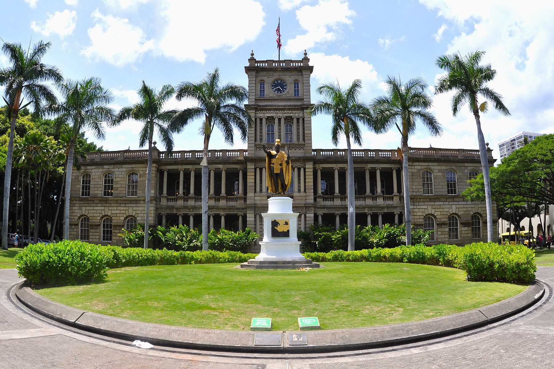
The court that decided In re Water Use Permit Applications... Waiāhole Ditch Combined Contested Case Hearing, 94 Haw. 97, took more than two and a half years to rule, and when it did, on August 22, 2000, Justice Paula Nakayama's opinion for the court, over a dissent by Justice Ramil, assembled, in one place, the full legal architecture of the state's public trust in water. The doctrine's American ancestor is Illinois Central Railroad Co. v. Illinois, an 1892 U.S. Supreme Court case holding that a state cannot simply give away its interest in the submerged lands beneath navigable waters held for public use. Hawaiʻi's own courts had already built on that foundation for decades: King v. Oʻahu Railway, decided in 1899, recognized a Hawaiian public trust in navigable waters, and in 1973's McBryde Sugar Co. v. Robinson the Hawaiʻi Supreme Court traced the principle back to the Great Māhele of 1848, when the Hawaiian Kingdom, even as it converted land to private ownership, expressly reserved the right to water for the common good of the people. In 1982's Robinson v. Ariyoshi, the court described that reservation as imposing "a public trust... upon all the waters of the kingdom," language the Waiāhole court now quoted directly. In 1978, Hawaiʻi voters had gone further and written the doctrine into the state constitution itself, in Article XI, sections 1 and 7, declaring that "all public natural resources are held in trust by the State for the benefit of the people" and that the state has "an obligation to protect, control and regulate the use of Hawaiʻi's water resources for the benefit of its people." The 1987 State Water Code implemented that mandate by statute. The Waiāhole court held that this statutory machinery left the older constitutional trust in place; the Code operated alongside it.
What the Court Ordered
Then the court applied all of it. It rejected the leeward parties' central argument that the trust covered only surface water, ruling that the state's constitutional obligation reaches groundwater too, without exception. It held that the trust protects navigation and commerce, its historic American purposes, and also the maintenance of streams in something close to their natural state, domestic water use, and the exercise of traditional and customary Native Hawaiian rights, the kind that windward farmers and families were defending when they grew kalo and gathered native stream life. It refused, pointedly, to extend the trust to cover private commercial development for its own sake, rejecting the leeward landowners' argument that any beneficial economic use automatically served the public interest. Most consequentially for how future cases would be argued, the court flipped the practical burden of proof: the party asking to divert water must justify taking it out, under a presumption the opinion set in favor of trust purposes. Where scientific evidence about a stream's needs was incomplete, and the record showed the Commission itself calling that evidence "preliminary" and its conclusions "tentative," the court held that uncertainty should count in favor of protecting the resource, a formal adoption of the precautionary principle into Hawaiʻi water law.
The record supplied a concrete illustration of what that shifted burden meant in practice. The Commission had granted leeward farmers a blanket allowance of 2,500 gallons per acre per day for every acre zoned for diversified agriculture, whether or not that acre held a crop in a given season. Farmer Alec Sou testified that only about one-third of his land was in actual cultivation at any given time, the rest resting through harvest, plow-down, and pest control; farmer Larry Jefts held a lease on 620 acres yet was permitted water for the full acreage regardless of what was actually growing on it. The court found the Commission's own allocation contradicted the evidence in its own record and vacated the 2,500-gallon figure, ordering future allocations tied to land actually farmed.
Applying the same standards elsewhere in the record before it, the court vacated a 5.39-million-gallon-a-day "buffer" the Commission had set aside for future offstream use, finding it inconsistent with the trust; struck down permits the Commission had granted to the Campbell Estate for fields its own tenants could not show they were using for the crops claimed; vacated a permit for Puʻu Makakilo, Inc.'s golf course because the Commission never explained why the course could not use groundwater instead; and rejected outright Kamehameha Schools' claim that it held special "aliʻi" rights, tracing to Hawaiian monarchy-era land grants, to pump unlimited groundwater beneath its own leeward lands. The court affirmed parts of the Commission's decision, vacated others, and sent the whole matter back for further proceedings "consistent with this opinion."
Farmer Charlie Reppun said afterward, "Our very survival depends on understanding, maintaining, and enhancing the island ecology we are part of." Earthjustice attorney Paul Achitoff, who represented the windward petitioners, called the ruling a vindication of "the public interest in our water resources" against "intense political pressure," which included the governor's public criticism of the proposed decision and the attorney general's personal role before the Commission.
Water Returns, Slowly
Winning the case did not instantly refill the streams. The Commission's first order after the remand, in December 2001, allotted leeward users about 13.3 million gallons a day and set about 9.9 million gallons a day for Waiāhole, Waianu and Waikāne streams, an increase but a modest one measured against the ditch's 27-million-gallon average flow. When the Commission's follow-up order still fell short of what the Supreme Court had directed, the windward parties appealed again, and won again in 2004, when the court once more sent the Commission's decision back. Stream flows were not finally set until the Commission's third decision, in 2006, which Earthjustice reported as setting 12 million gallons a day for four windward streams and 12.57 million for leeward permits. The ditch itself did not go away. In 1998 the legislature authorized, and in July 1999 the state's Agribusiness Development Corporation completed, the purchase of the Waiāhole system from the sugar company's corporate parent, a year before the Supreme Court ruled; it still operates the system today, delivering water to diversified farms on former cane land under a permitting structure built directly out of the 2000 decision's requirements. The same 1998 law wrote the system into the state's environmental review statute: Hawaiʻi Revised Statutes section 343-6.5, titled "Waiahole water system; exemption," exempts the purchase of the system's assets from that review, a small but telling sign of how thoroughly one piece of century-old irrigation infrastructure became embedded in state law.
The Machine Becomes a Precedent
The Waiāhole decision reached beyond one ditch on one island. In 2012, the Hawaiʻi Supreme Court applied the same public trust framework to Nā Wai ʻEhā, the "four waters" of central Maui, and sent the Commission's stream-flow decision back for a new look at the sugar plantations' diversions. When wildfire tore through Lahaina in August 2023, the resulting scrutiny of West Maui's water diversions, including a state water official's delayed approval of a West Maui company's request to divert stream water into its reservoirs, played out inside the legal vocabulary the Waiāhole court had built: whose burden is it to justify a diversion, and what happens to that burden when the emergency is a fire. The Hawaiʻi Supreme Court reaffirmed the same public trust principles again on June 20, 2024, in a second Nā Wai ʻEhā decision that cites Waiāhole throughout. Community groups fighting to restore stream flows in each of these later cases inherited something the Waiāhole-Waikāne farmers had to fight for in court: a body of law that already put the burden of proof on the diverter.
The tunnel through the Koʻolau Range still runs. Water still leaves Kahana Valley, crosses under the mountain crest at Adit 8, and falls toward fields that no longer grow sugar. In the summer of 2000 the law changed, and with real teeth it decided who the machine was allowed to answer to. Sibling editions trace the same infrastructure-and-accountability question elsewhere: The Observatory That Turned a Volcano into a Century-Long Signal and The Gate That Thinks With the Tide.


_(19217570623).jpg)