The story
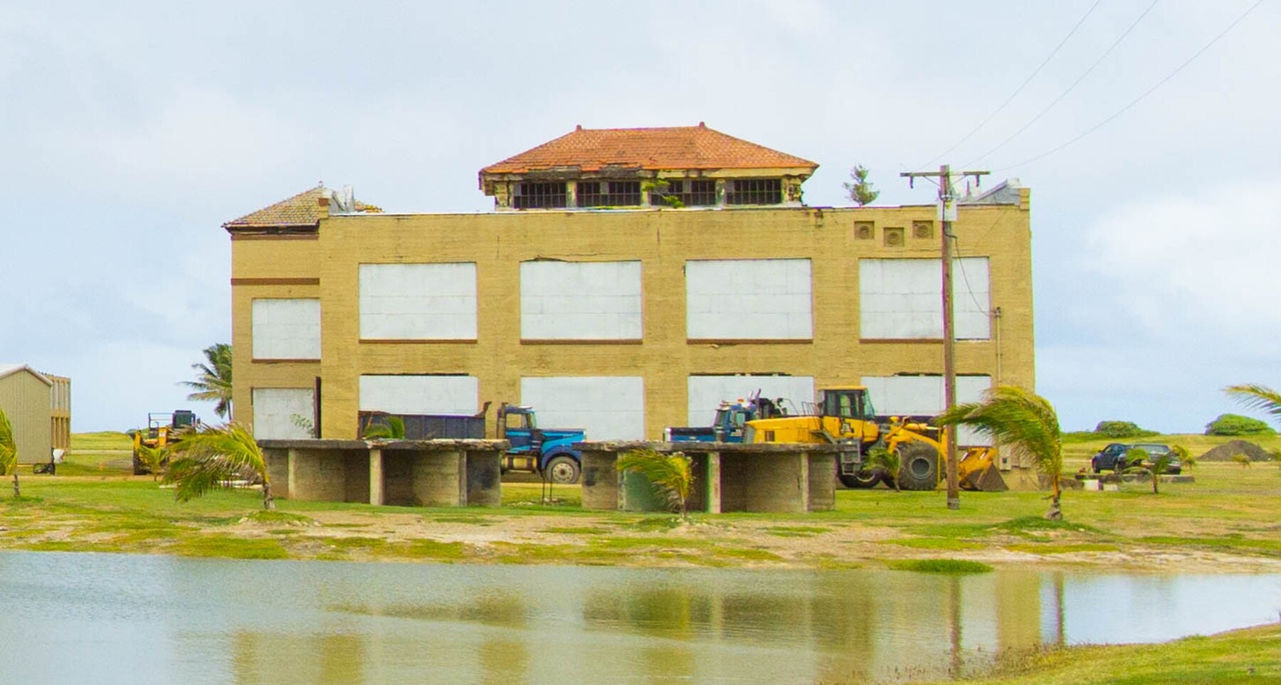
The lighthouse went first. At Scotch Cap, on the ocean side of Unimak Island near the tip of the Aleutian chain, a reinforced-concrete Coast Guard station stood watch over one of the roughest stretches of water in the North Pacific. At roughly 1:29 a.m. local time on April 1, 1946, the seafloor south of the island lurched in a shallow megathrust rupture that modern seismologists now put at magnitude 8.6, roughly a full point higher than the 7.4 that instruments of the day could register. Forty-eight minutes later a wave with a run-up estimated at more than 100 feet came ashore and erased the lighthouse. All five Coast Guardsmen inside were killed. Nobody outside Unimak knew it had happened, because the wave had also destroyed the radio equipment that would have reported it.
That silence is the hinge of this story. A tsunami generated in Alaska crossed nearly 2,300 miles of open Pacific with no one able to say it was coming, and it did so in well under five hours: 4.9 hours to Hilo, by the U.S. National Centers for Environmental Information's later reconstruction, 4.5 hours to Kauaʻi, about 5 hours to Honolulu. There was no seismic network wired to Hawaiʻi that could have flagged the Aleutian earthquake in real time, no chain of tide gauges reporting sea-level anomalies back to a central desk, and no protocol for turning either into a public alarm. The technology to build such a system existed in pieces. Nobody had yet assembled it. Hawaiʻi found out why that mattered at breakfast time, on a date that gave the disaster its lasting, almost cruel nickname in island memory: the April Fools' Day Tsunami.
What the wave did
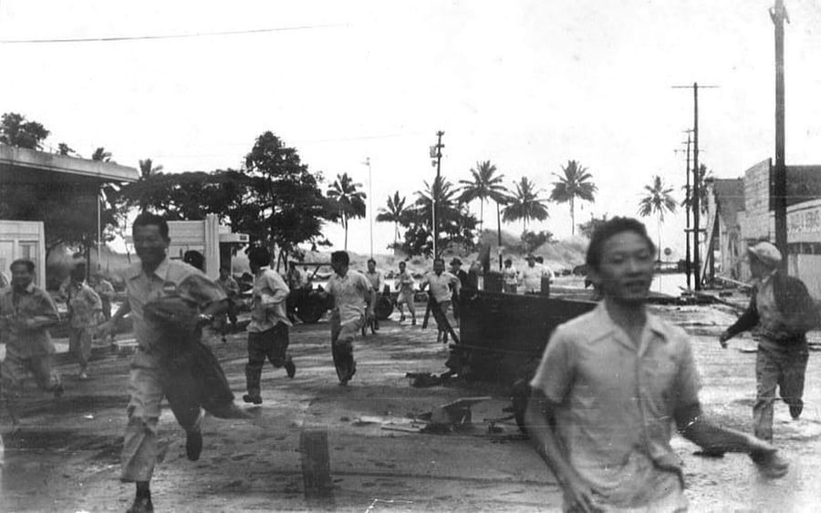
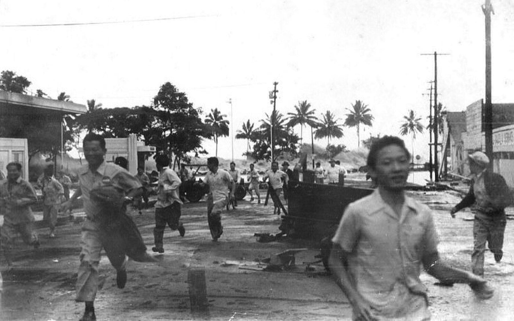
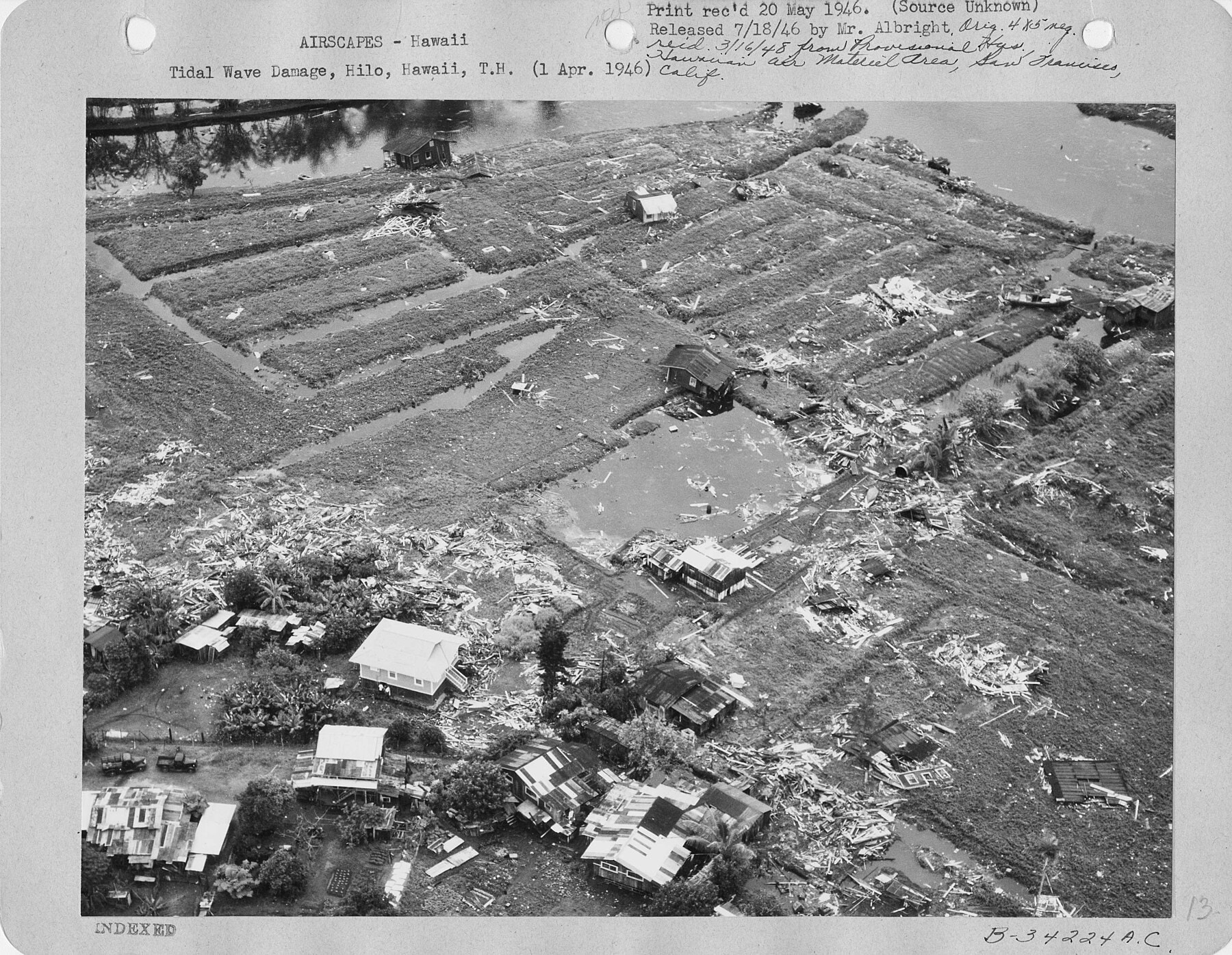
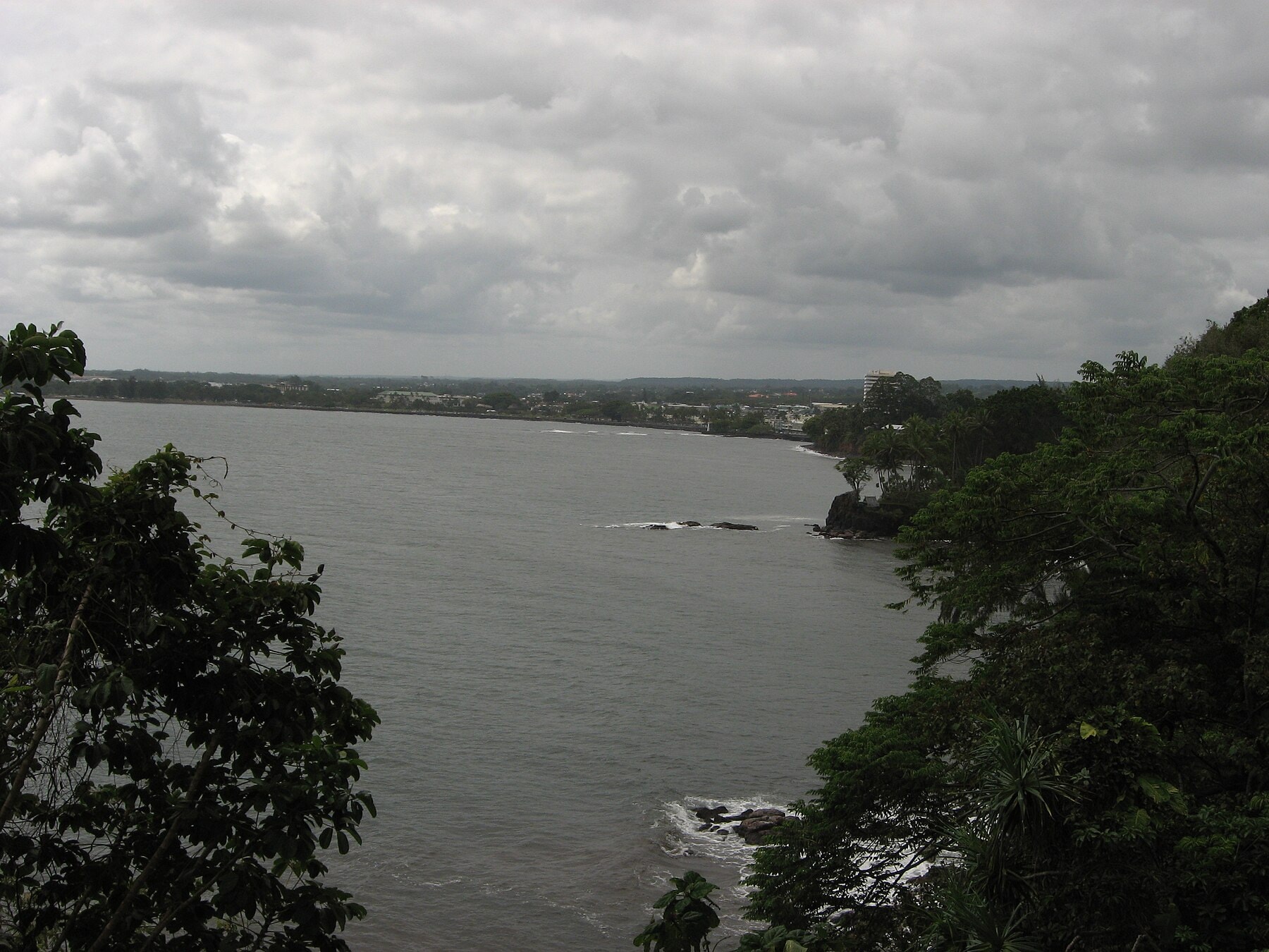
The Pacific Tsunami Museum, the U.S. Geological Survey, and NOAA's own historical tsunami catalogs converge on the same grim arithmetic: 158 people killed across the territory of Hawaiʻi, 96 of them in Hilo alone. In Hilo, the bayfront business district (the low, flat shelf of downtown that had grown up around the harbor) took the worst of it. Waves reported as high as 55 feet crest to trough tore through the waterfront, and when the water receded, 488 buildings had been demolished and another 936 damaged. A hundred sixty-three people were injured badly enough to need treatment. The property-damage tally came to roughly $26 million in 1946 dollars, north of $400 million today.
Hilo's bayfront business district had a name and a population before it became a statistic. Three solid blocks of it, hard against the harbor, made up Shinmachi, a Japanese immigrant quarter built up after 1913 and known locally as Little Tokyo: family-run shops, Buddhist and Shinto temples, and businesses like the Hawaii Planing Mill, S. Tokunaga Sports, the Hilo Macaroni Factory, and Atebara's potato-chip company. The wave took down nearly all of it; at least 38 people died in Shinmachi that morning alone. The one structure left standing on the site afterward was a Coca-Cola bottling plant. Shinmachi was never rebuilt. The land it stood on is now part of Wailoa River State Recreation Area, a stretch of parkland carrying almost no visible trace of the neighborhood that used to fill it.
Maui took its own share of the damage: 14 people killed, 77 homes and buildings destroyed, and roughly 550 residents left homeless along the north shore, at Hana and at Maliko Bay, where a wave described by one survivor as looking at first like nothing more than an unusually slow-moving swell erased an entire family's homestead. The islands most exposed to open Pacific swell, the Big Island's east-facing Hāmākua and Puna coasts and Maui's north shore, took the worst of it, while more sheltered leeward shores were spared the highest run-ups.
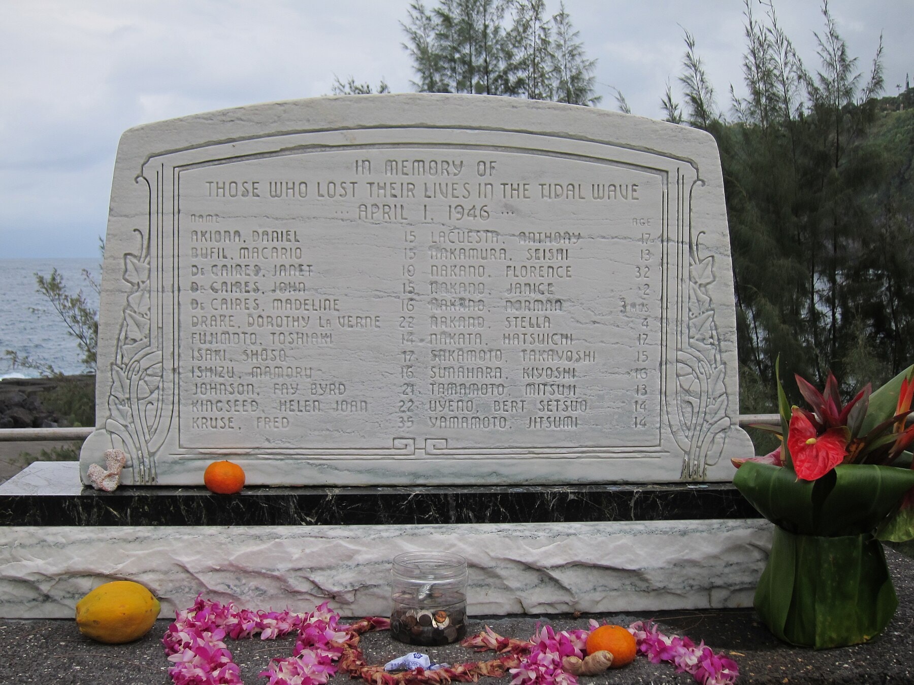
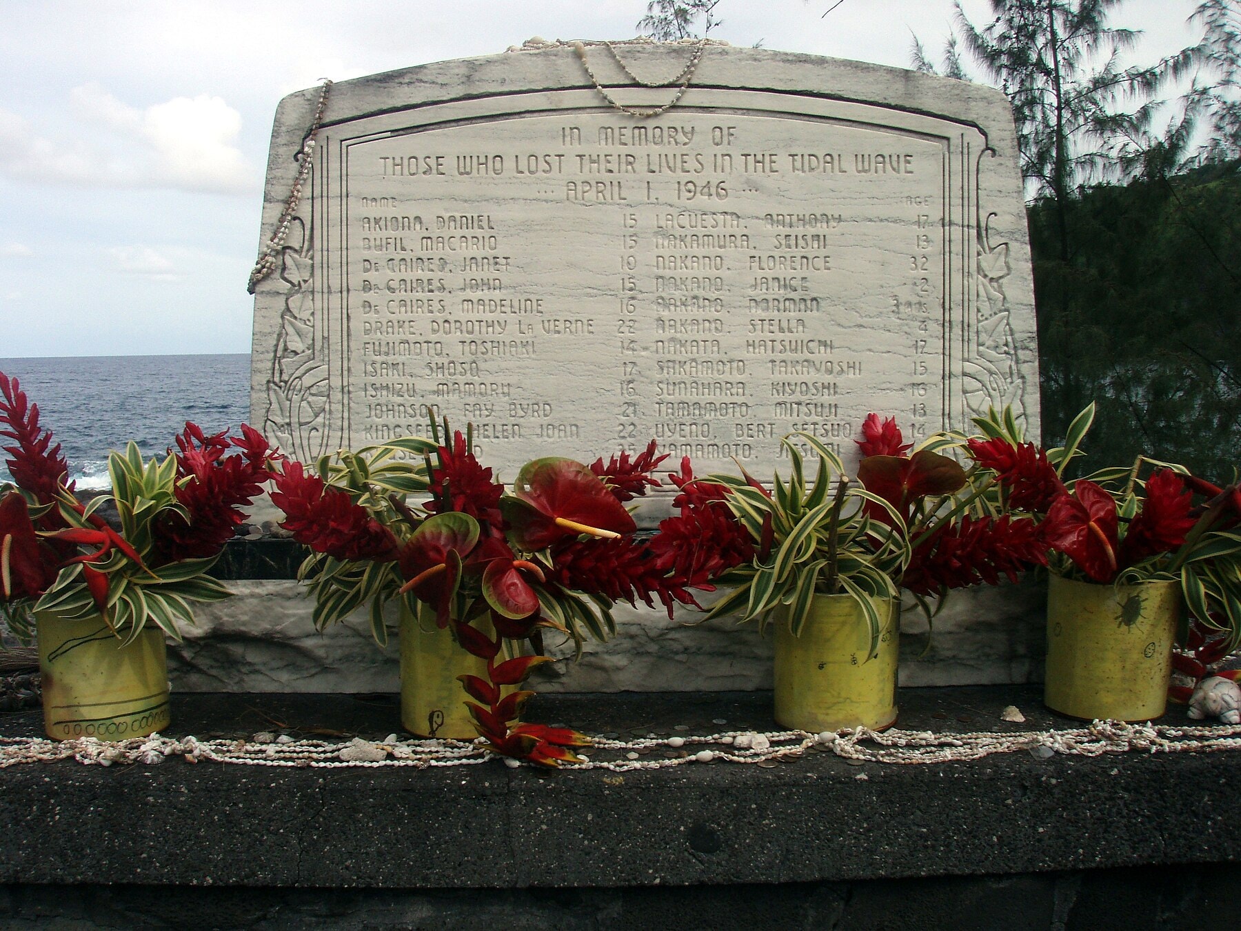
Thirty miles up the Hāmākua coast from Hilo, at Laupāhoehoe Point, the wave found a public school built almost at sea level on a low peninsula. Twenty-four people died there, the great majority of them students, along with several of their teachers, when the waves swept the schoolhouse and staff cottages off the point. A memorial at Laupāhoehoe today lists their names individually, because for decades afterward that was the only official record anyone kept.
One of the Laupāhoehoe teachers who did not die left behind an account detailed enough to reconstruct almost minute by minute. Marsue McGinnis, twenty years old and seven months into her first teaching job after arriving from Ohio the previous September (born in Cincinnati, the daughter of a Miami University journalism professor, and recruited by a flyer promising teaching jobs on the islands) watched the bay empty out that morning like, in her own later description, a bathtub draining, and then watched colleagues and students wander down to gather fish stranded on the exposed reef, thinking little of it. The third wave was the one that mattered. "It came and it just kept coming," she said afterward. "It didn't crash. It kept coming and got bigger." It took her cottage, and her with it. She spent nine hours in the open ocean clinging to wreckage, watching some of her own students drown nearby, before a doctor named Leabert Fernandez, who had found a boat forty miles away and put to sea that afternoon, pulled her and two surviving boys out of the same debris field. Three of her roommates did not survive the morning. Fernandez proposed within days; they married three months later, and he went on to practice as a plastic surgeon while she kept teaching and raised three children (daughters Tracy, Linda, and Holly) on the island that had nearly killed her, later teaching at Kailua Intermediate and Punahou School.
Survivor accounts collected since then describe the same failure of recognition playing out up and down the island chain. At Nāwiliwili Bay on Kauaʻi, one boy's mother realized what was coming only when she saw the harbor bottom exposed, the water having drained out ahead of the first crest. At Maliko Bay on Maui, a family watched what looked like "just one small wave" roll in gently before the father recognized it for what it was and got everyone uphill in time. At Lāʻie on Oʻahu, a fifteen-year-old climbed an ironwood tree and watched the reef go dry, then watched the second wave arrive three or four times the size of the first. None of them had been told what a receding shoreline meant, because nobody whose job it was to tell them existed yet.
It was not the first time Hawaiʻi had been caught unwarned. Thomas Jaggar, the volcanologist who founded the Hawaiian Volcano Observatory, had tried to alert Hilo's harbormaster ahead of a 1923 tsunami generated by a Kamchatka earthquake, using nothing more than his own reading of the seismic and tidal record. The warning went nowhere. There was no institution to receive it, act on it, or repeat it to the public, and Jaggar's instinct (that an earthquake on one side of the Pacific was information the other side needed within hours, not days) died with the moment. It took the deaths of 1946 to fund what Jaggar had tried to do for free.
The 1946 failure had a second, more embarrassing layer beneath the obvious one. The Hawaiian Volcano Observatory, Jaggar's old post on Kīlauea, still ran seismographs in 1946, staffed by fewer than four people working a Monday-through-Friday schedule. Its drum recorded the ground waves from the Aleutian earthquake in the pre-dawn hours of April 1, a Monday, hours before the wave reached Hilo. Nobody read the record until around 7:30 a.m., after the water had already come and gone. An instrument capable of giving the islands real warning was already running, on the very island the wave would hit hardest. The missing piece wasn't seismology. It was somebody awake to look at the paper.
Much of what is known today about how unevenly the wave struck the islands comes from a single, unglamorous piece of fieldwork done in the months afterward. Francis Shepard of the Scripps Institution of Oceanography, Gordon Macdonald of the U.S. Geological Survey's Hawaii office, and Doak Cox, a geologist for the Hawaiian Sugar Planters' Association, walked the coastlines of the affected islands measuring wave run-up at intervals rather than relying on secondhand estimates, and published their findings in 1950 as a Scripps Institution bulletin running past 130 pages. Their central finding undercut the easy intuition that a bigger earthquake or a more exposed coastline simply meant a bigger wave: run-up heights at adjacent points on the very same shoreline sometimes varied by a factor of several, shaped by underwater topography in ways nobody could yet predict from a map. That unevenness is why some blocks of Hilo's waterfront were leveled and others, a few hundred feet away, were left standing.
Building the system out of what was already lying around
The agency that inherited the problem was the U.S. Coast and Geodetic Survey, the same federal bureau, later folded into NOAA, that had run seismographs and tide gauges across the Pacific for decades without anyone wiring them together for this purpose. In 1947 the Survey stood up an ad hoc, earthquake-triggered warning operation with no dedicated budget of its own, a sign of how uncertain Washington still was that this was a solvable problem. The Seismic Sea Wave Warning System became fully operational on August 12, 1948, headquartered at the Survey's magnetic and seismological observatory in Honolulu and leaning on the U.S. Navy's existing communications network to move data and bulletins around the Pacific, because building a dedicated one would have taken money nobody had appropriated. Congress did not fund the operation as a standing line item until 1949, a full three years after the disaster that had made it necessary; by then the system had already been running for a year on borrowed Navy circuits and Survey staff time nobody had formally been told to spend that way.
The engineering core of the system came from one officer's close reading of the 1946 disaster. Commander Charles K. Green of the Coast and Geodetic Survey (a career hydrographic engineer who had joined the Survey in 1916 and spent the 1930s running triangulation surveys of the Northern Channel Islands off California before the war) went back through the tide-gauge records from that April morning and did the arithmetic the agency had failed to do in real time: given the known travel speed of a tsunami in open ocean, how long should the wave have taken to reach each station, and did the actual tidal charts confirm it arrived on schedule? They did, at some twenty stations spanning the eastern Pacific from the Aleutians to Chile, the full breadth of what Green analyzed in his 1946 paper for the American Geophysical Union. Green also noticed something more useful than travel time alone: a signature. On the paper tide charts, a tsunami's arrival showed up as a small, almost unremarkable rise in sea level followed by an outsized withdrawal, repeating on a cycle of ten to twenty minutes, distinct from the shorter, choppier rhythm of wind waves and the slower rhythm of ordinary tides. Build a system that watches for that specific signature, Green reasoned, and you can filter out the ocean's normal noise and catch the real thing.
That insight became the spine of the Seismic Sea Wave Warning System: a network of seismograph stations (four of them, to start) to catch the earthquake itself and estimate its size and location; a Pacific-wide network of nine tide gauges to confirm whether an actual wave had been generated and to clock its progress; a travel-time chart, refined from Green's calculations, that let analysts predict an arrival time for any coastline in the basin once they knew where the quake had struck; and the Navy's radio and cable network to carry both the raw data and the eventual warnings. It was a shoestring operation built by people who had just watched what happens without one, and some of them had watched it more literally than most: a group of American oceanographers happened to be in Hilo on April 1, 1946, for meetings connected to the Bikini Atoll atomic bomb tests, and the disaster interrupted their conference in person. Scientists who had come to the Big Island to talk about the physics of one kind of ocean-borne shockwave left having survived another, and several of them carried that firsthand urgency directly into the postwar push to fund a warning network.
The system's other unglamorous but essential ingredient was the willingness to keep a running tsunami travel-time chart current for the entire Pacific basin, not just the routes an earthquake happened to have used before. Any coastline could be the next Unimak Island; the chart had to answer, for a quake anywhere in the basin, how long Honolulu had before deciding whether to sound an alarm.
Proof, and the limits of proof
The system got its first real test on November 4, 1952, when a magnitude 9.0 earthquake ruptured off Kamchatka, bigger, by most modern estimates, than the 1946 Aleutian quake had been. The Honolulu warning center detected it, calculated the tsunami's likely path and arrival time, and issued a warning to Hawaiʻi hours ahead of the wave. No one in the islands died. It was the first time the machinery built after 1946 had been asked to do the one thing it existed for, and it worked.
A basin-wide tsunami generated by the 1957 Andreanof Islands earthquake, magnitude 8.6, tested the system again on March 9 of that year, and a Coast and Geodetic Survey technical bulletin written two years later by an agency oceanographer named Garrett Salsman laid out exactly how the machinery performed, minute by minute. The earthquake struck at 1428 Greenwich time, roughly 100 miles southeast of Adak Island; ground waves reached the seismograph at the Honolulu Magnetic Observatory six minutes later and tripped its alarm, while stations at Fairbanks, Sitka, Berkeley, Tucson, Baguio, Tokyo, and Sapporo recorded the same jolt and relayed their readings to Honolulu. Within an hour, analysts had located the epicenter at 51°N, 175°W. Tide gauges confirmed the rest: Unalaska reported a four-foot wave at 1547 Greenwich time, Adak a nine-foot rise three minutes after that. By 1552, barely ninety minutes after the earthquake, the Navy, the Weather Bureau, and the police already held a preliminary warning; by 1655 the center had issued predicted arrival times, 1745 at Midway and 1845 at Honolulu. Salsman's bulletin preserved a few odder, human-scale details of that afternoon: the ocean liner Lurline and a clutch of freighters put out from Honolulu Harbor rather than wait at the dock, and the submarine USS Wahoo, tied up at Nāwiliwili on Kauaʻi and braced for waves of no more than a foot, found the harbor draining and refilling hard enough that the vessel moved sternward even while running its engines at flank speed trying to leave. Fifty-four tide stations across the Pacific recorded the wave that day. No one in Hawaiʻi died, though the islands still absorbed roughly $3 million in property damage, a real, destructive tsunami that the warning system had converted from a body count into an insurance claim. (Salsman's own comparison table, tallying the three major tsunamis of 1946, 1952, and 1957 side by side, listed the 1946 Hawaiʻi death toll at 173, higher than the figure used elsewhere in this account, a small reminder that even the Survey's own internal record-keeping never fully agreed on how many people the 1946 wave had killed.)
The 1952 test came with an irony that took decades to surface. The earthquake struck off Kamchatka, then and now Soviet and, in 1952, sealed behind Cold War secrecy so total that Pravda ran its Revolution Day coverage the same week without a line about an earthquake or a wave. The tsunami had in fact killed an estimated 2,336 people in the fishing town of Severo-Kurilsk, on the Kuril Islands south of the peninsula, with waves reported up to 12 meters high, a toll the Soviet state classified and did not acknowledge until archives opened in the early 2000s. Honolulu's warning center, working only from the timing and behavior of the waves that reached Hawaiian tide gauges (up to 2.4 meters high when they arrived), reconstructed the earthquake's approximate location in the northwest Pacific using nothing but wave-speed physics. For a few days in November 1952, an American tsunami-detection system built in direct response to its own country's disaster knew more, in effect, about a Soviet one than the Soviet public was permitted to know.
Those successes bought the program continued funding and, in time, international attention. But the system's most important lesson came from a case where the warning worked and people still died. On May 22, 1960, a magnitude 9.5 earthquake near Valdivia, Chile (still the largest earthquake ever instrumentally recorded) sent a tsunami racing across the entire Pacific basin. The Honolulu center's warning was, by any technical measure, a success: at 6:47 p.m. Hawaiʻi time, the Coast and Geodetic Survey issued an official bulletin that a wave was expected to reach Hilo around midnight, giving the city more than five hours of lead time. Sirens sounded that evening across Hilo. Sixty-one people died anyway, and 282 more were injured.
The gap wasn't seismology. It was interpretation. Nearly everyone in Hilo heard the sirens; investigations afterward found that only about a third of those who heard them understood the sound as an order to evacuate immediately, with no further notice to follow. Some waited for a second signal that never came. Some had heard sirens before for warnings that fizzled and assumed this one would too. The 1960 tsunami is the moment the story stops being only about physics and travel-time charts and becomes about the harder problem the warning system exposed rather than solved: a correct forecast, communicated imperfectly, still kills people. It is also the reason Hawaiʻi's civil-defense siren protocols and public tsunami education (the monthly test sirens residents still hear today, the beach-park signage, the school evacuation drills) trace their lineage directly back to a night when the warning arrived on time and the message still didn't land.
From a Honolulu observatory to a Pacific institution
The Chile disaster also internationalized what had started as a single agency's improvisation. By 1965 the Honolulu operation had been renamed the Pacific Tsunami Warning Center, and in 1968 the Intergovernmental Oceanographic Commission, acting under the United Nations, created the Intergovernmental Coordination Group for the Pacific Tsunami Warning System, a standing body of Pacific-rim nations coordinating on exactly the kind of information-sharing that had failed Chile's neighbors and Hawaiʻi alike in 1960. The United States offered its Oʻahu facility, by then relocated to ʻEwa Beach, as the group's operational headquarters. What began as a Honolulu observatory with four seismographs became the coordinating node for a Pacific-wide system; membership has since grown to roughly 46 countries and territories bordering the ocean the center was built to watch.
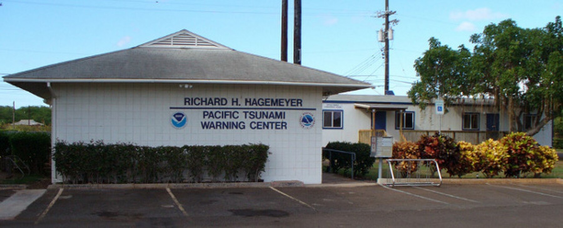
The center kept absorbing lessons the way it had absorbed Green's tide-gauge signature. After a magnitude 7.2 earthquake struck Hawaiʻi Island's Kalapana coast in 1975 and generated a local tsunami, the center, until then built almost entirely around distant, teletsunami threats from across the ocean, began issuing warnings for near-source events that would strike Hawaiian shores in minutes rather than hours, a fundamentally different and much less forgiving warning problem. In 2001 the facility was rededicated as the Richard H. Hagemeyer Pacific Tsunami Warning Center, honoring a former director whose tenure had helped modernize its operations.
The 2004 Indian Ocean tsunami, which killed roughly 230,000 people across a dozen countries with no coordinated warning system to catch it, did to the Pacific center what 1946 had done to the Coast and Geodetic Survey: it forced an institution built for one ocean to reckon with its absence everywhere else. The Hagemeyer center's advisory responsibilities were expanded to cover the Indian Ocean, the South China Sea, the Caribbean, and other basins that had no equivalent of their own yet, and its staff grew from eight to fifteen to sustain genuine round-the-clock, seven-day coverage rather than an on-call rotation. In 2005 it began issuing local tsunami warnings for Puerto Rico and the U.S. Virgin Islands, regions an Aleutian-earthquake-era warning system, built by and for the Pacific, had never been designed to serve.
What the network looks like now
The system Commander Green built from four seismographs and nine tide gauges had already grown fivefold by the time it was renamed in 1965 (to roughly 20 seismic stations and 40 tide stations ringing the Pacific) and has become, by NOAA's own accounting, a network of roughly 600 seismic stations and about 500 coastal and deep-ocean sea-level stations feeding data to the warning centers continuously today. The most important addition to that network arrived in the 1990s: the Deep-ocean Assessment and Reporting of Tsunamis system, DART for short, a chain of seafloor pressure sensors moored across the open Pacific that can detect a tsunami wave passing overhead in water two or three miles deep, long before it reaches any coastline's tide gauge. Where Green had to infer a tsunami's existence from how the water behaved once it reached shore, DART lets today's center watch the wave itself, mid-ocean, within minutes of generation.
That capability proved itself on March 11, 2011, when a magnitude 9.0 earthquake off Tōhoku, Japan, produced the tsunami that would go on to overwhelm the Fukushima Daiichi nuclear plant. A DART buoy moored roughly 600 kilometers off Sendai, in water 5.6 kilometers deep, recorded a wave amplitude of nearly two meters about 25 minutes after the earthquake, the largest signal any DART sensor had ever measured. Using that real-time deep-ocean data, NOAA produced the first tsunami inundation forecast ever generated and issued before the wave reached its target coastline, modeling flooding for Kahului, Maui, and other Hawaiian sites hours ahead of arrival. The wave that eventually reached Hawaiʻi crested at 5.7 feet at Kahului; over the following 25 hours, the Pacific center issued 27 international bulletins to Pacific basin nations and 16 separate messages to the state of Hawaiʻi, tracking an event that a 1948-vintage system, built around paper tide charts and Navy radio circuits, could never have modeled in anything like real time.
The center itself has moved twice since 1948: from the original Honolulu magnetic and seismological observatory to a facility at ʻEwa Beach, and more recently to Building 176 on Ford Island, inside Pearl Harbor. Every Pacific-rim earthquake large enough to matter has been watched for from one of those three Oʻahu addresses since 1948. The equipment inside has gone from ink traces on rotating paper drums to a facility processing satellite telemetry and seafloor pressure data around the clock. The mission printed on Green's original travel-time chart has not changed: figure out, before the wave arrives, whether it is coming, and say so in time for it to matter.
What Hilo kept
Hilo rebuilt its bayfront twice: once loosely after 1946, then far more deliberately after the 1960 tsunami killed 61 more people in nearly the same low-lying blocks, at which point the city converted much of the flood-prone waterfront into parkland rather than rebuilding it as before.
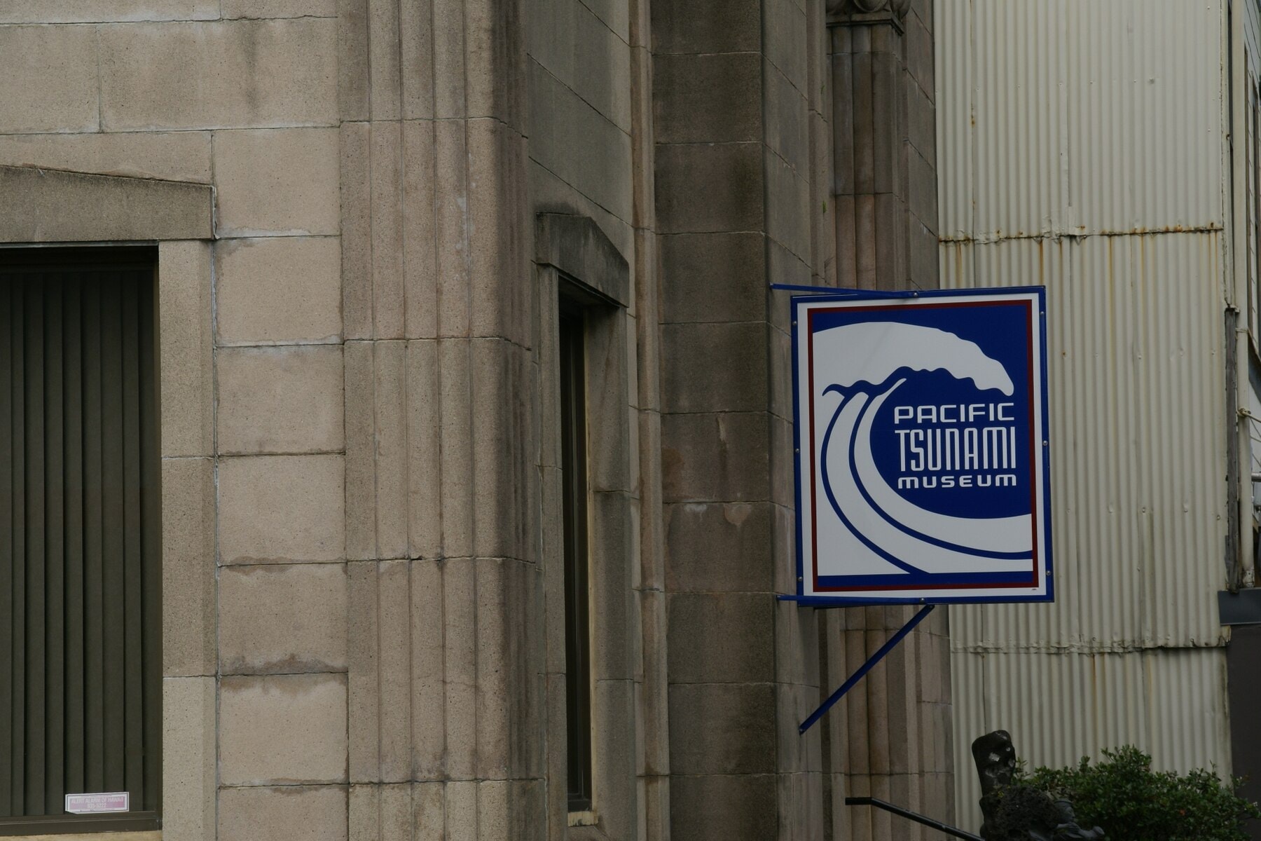
The Pacific Tsunami Museum occupies a former First Hawaiian Bank building at 130 Kamehameha Avenue, a few blocks from where the 1946 wave came ashore. The building itself is a small artifact of the disaster in its own right: designed in 1930 by the Hawaiʻi architect C.W. Dickey in an Art Deco style, it survived both the 1946 and 1960 tsunamis intact while much of what surrounded it did not. A few blocks away, the S. Hata Building, a 1912 commercial block put up by the Japanese immigrant businessman Sadanosuke Hata, survived 1946 on nothing more than solid construction, though the 1960 wave forced its basement to be filled in for good. First Hawaiian Bank donated its former building to the museum in December 1997, and the museum opened to the public there in June 1998. It exists at all because a University of Hawaiʻi at Hilo professor, Walter Dudley, started collecting survivor accounts in 1988 for a book he was writing, and one of the people who told him her story, a 1946 survivor named Jeanne Branch Johnston, decided the material needed a permanent home rather than just a manuscript. Dudley, Johnston, and a researcher named Michael Childers spent the years afterward building what has become an archive of more than 450 survivor narratives, drawn not only from Hawaiʻi but from Alaska, India, Sri Lanka, Thailand, and the Maldives. The museum's own recent history is a smaller, quieter reminder of how fragile this kind of institutional memory can be: it laid off its entire paid staff and suspended regular operations in December 2024 over a funding shortfall, reopening in 2025 on a reduced, volunteer-supported schedule while its board pursued a multi-year fundraising plan. The museum's current director, Cindi Preller, came to the job in 2022 by way of the system this story is actually about: a geologist by training, she spent seventeen years as a senior duty scientist at the National Tsunami Warning Center in Palmer, Alaska, and the Pacific Tsunami Warning Center on Oʻahu, the first woman to work both posts, on duty for every tsunami that reached land during her tenure. She shifted from forecasting tsunamis to collecting their stories after the 2004 Indian Ocean disaster, and met Dudley and Johnston while they were in Alaska gathering survivor accounts of their own. "I feel like those interviews and survivor stories are the heart and soul of the museum," she has said.
Laupāhoehoe's school was relocated to higher ground after 1946; the peninsula where twenty-four people died is a park today, marked by the memorial that carries their names.
None of that rebuilding is what Hawaiʻi is best remembered for contributing to Pacific science, though. The more durable legacy is procedural and largely invisible: a chain of seismographs, tide gauges, and now deep-ocean pressure sensors that did not exist on April 1, 1946, feeding a center in Honolulu that did not exist either, built by an agency working without a dedicated budget, off the insight of one naval officer rereading tide charts from a disaster that had already happened. Every one of the roughly 46 nations now inside the Pacific Tsunami Warning System's coordination group is, in a narrow but real sense, still operating on the system Hawaiʻi was forced to build the hard way, after the wave, rather than before it.


.jpg)